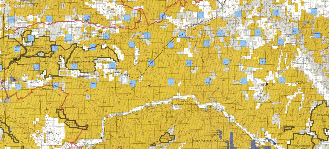
Many organizations that deal with legal descriptions based on Township, Range and Section need to be able to quickly search and locate where the land is spatially. This is why DDS developed a free PLSS Search Utility that enables users to enter the Township, Range, and Section of any given site, and locate that information in an our interactive map.. Not only can users view the Townships and Section Grids, but base layers such as topographic and satellite imagery can be toggled on and off giving users a digitized map that can be exported. DDS also sells the land grid in vector formats, at a nominal price. These base layers can include data from Esri ArcMap (ArcDesktop), Petra, GeoGraphix, AutoCAD, plus many other CAD and GIS applications. All data layers include Township and Section Boundaries. Tabular GIS attributes include Meridian, Township, Range, and Section Numbers.
Digital Data Services, Inc. (DDS) are experts in Data Consultation, Collection, Conversion, Organization, Analyses, and Presentation as it relates to spatial information. As a Geospatial Information Systems (GIS) Consulting Firm with expertise in providing custom solutions to meet the requirements of today’s businesses; we serve our clients by turning complexity into simplicity. With a passion for perfection, DDS' objective is to provide our clients access to the precise problem solving solutions and tools that will boost your company’s performance, yielding an elevated return on your investment.
Land Survey (Cadastral) Data
USGS Public Land Survey System Land Grid Data- DDS's Public Land Survey is digitized from USGS 1:24,000 series topographic maps using a highly accurate spatial averaging digitizing technique, which captures corner boundaries to +/- 40 foot accuracies. The Wyoming resurveys are included and Carter townships are used for Kentucky and Tennessee. There is an option to purchase the BLM-based land grid, or the USGS-based land grid. The USGS-based land grid will precisely match the section lines from the 1:24,000 scale USGS topographic maps.
Texas Land Survey Data- DDS is pleased to offer Texas Land Survey datasets. The Texas Land Survey dataset is a seamless, high-resolution database of county boundaries, blocks, surveys, abstracts, subdivisions, lots, and tracts that is ideal for base maps and plotting land ownership and leases.
PLSSFinder™ is a free application that enables users to download up to 9 townships of BLM-based Public Land Survey grid in an Esri .shp file or File Geodatabase. The user has the ability to search by section, township, and range, download selected areas and/or print maps of the land survey information within a web-based map application. Users also have the option to purchase state or nation-wide bundles of our seamless Public Land Survey grid for use in ArcGIS, Petra, Geographix, or AutoCAD. For online orders, there is an option to purchase the BLM-based land grid, or the USGS-based land grid. The USGS-based land grid will precisely match the section lines from the 1:24,000 scale USGS topographic maps.
Texas Land Survey Data- Texas Land Grids
DDS is pleased to offer Texas Land Survey datasets. The Texas Land Survey dataset is a seamless, high-resolution database of county boundaries, blocks, surveys, abstracts, subdivisions, lots, and tracts that is ideal for base maps and plotting land ownership and leases.
Data layers include: County Boundary, Block, Survey, Abstract, Subdivision, Lot, Tract, Overlap Block, Overlap Survey, Overlap Abstract, Overlap Subdivision, and Overlap Lot. Subdivisions, lots, and tracts are available in attributed polygonal format. Tabular attributes include block, survey, abstract, subdivision, lot, and tract name and number.
Public Land Survey System Land Grid Data
Our Public Land Survey is a seamless, high-resolution database of Congressional Survey townships and sections that is ideal for base maps and plotting land ownership and leases. Public Land Survey is offered as either USGS PLSS digitized from USGS 1:24,000 series topographic maps, or BLM CAD NSDI PLSS land grid format. For the USGS derived product, DDS used a highly accurate spatial averaging digitizing technique, which captures corner boundaries to +/- 40 foot accuracies. Land grid matches the USGS 1:24,000 scale topo maps pricesly.
Features:
- Ready to use in all GIS and CAD software applications
- Pre-symbolized MXD template is be provided for ArcGIS Desktop and ArcGIS for Server users
- Pre-symbolized styles for AutoCAD and Global Mapper users
- Deploy the data through map servers such as ArcGIS for Server and MapServer
- A unified and consitent dataset across states under the PLS system
PLSSFinder™ is a free application that enables users to download up to 9 townships of BLM-based Public Land Survey grid in an Esri .shp file or File Geodatabase. The user has the ability to search by section, township, and range, download selected areas and/or print maps of the land survey information within a web-based map application. Users also have the option to purchase state or nation-wide bundles of our seamless Public Land Survey grid for use in ArcGIS, Petra, Geographix, or AutoCAD. For online orders, there is an option to purchase the BLM-based land grid, or the USGS-based land grid. The USGS-based land grid will precisely match the section lines from the 1:24,000 scale USGS topographic maps.


