Implementation for ArcGIS for Server & ArcSDE
Utilizing Current Technologies for Geospatial Analysis
As an Esri Silver business partner, the team at DDS understands the full capabilities of ArcGIS software. By utilizing ArcGIS and geographic information, the management of your operation will become much easier, and the solutions you need to take your company further will be easily identified.
A “right out of the box” solution is seldom the correct choice when dealing with any business, as their needs and workflows vary greatly. The team at DDS understands this, and it is our mission to provide a custom solution that will fit the needs of your organization. With our expertise in GIS, data management, and Esri software, you will be hard-pressed to find an organization that is better suited to handle the implementation of your ArcGIS for Server and any other related Esri products. Not only can DDS migrate your existing ArcIMS applications to ArcGIS for Server, but we can also enhance the framework of Arc and utilize our expertise in geospatial technology to find the perfect solution for your organization.
Whether you have already used Esri’s industry leading software in the past or are completely new to the world of ArcGIS, we can guarantee that the implementation of ArcGIS for Server will make your decision making much easier. Analyzing information will be simple; saving you time and money. As the world of GIS continues to move forward, don’t find yourself stuck in the past! Contact DDS today to find out just how much ArcGIS for Server can do for you.
- ArcGIS for Server
- ArcGIS for Desktop
- Custom GIS Solutions
- No Additional Software Required
- GIS Desktop & Web-based Solutions
- Enhancing ArcGIS Framework & Geospatial Technology
- Migrate Existing ArcIMS Applications to ArcGIS for Server
Print & Web Cartography
“Creating Visually Impressive GIS Mapping”
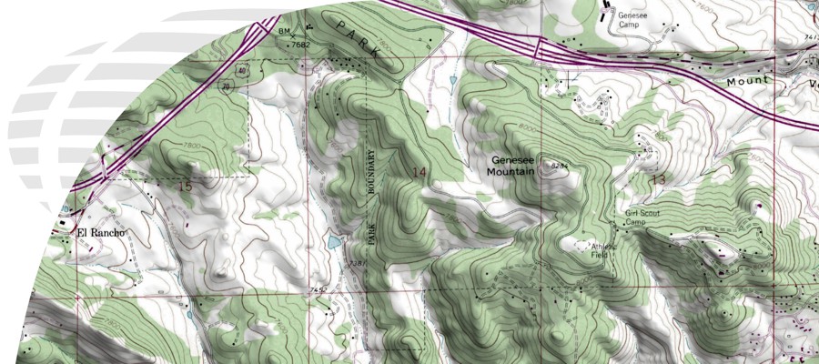
For any map or spatial analysis to be successful, the data must communicate to the user. Many times the time and expense of a detailed analysis is lost in the presentation. Map design and cartography is not "taking a picture." It involves structured processing, generalization, symbolization, and assembly. For any map to be effective, the data and graphic characteristics must be carefully chosen and integrated together. Map design involves intuition, rational choice, compromises, and like may fields, traditions and conventions.
The good cartographer is both a scientist and an artist. They must have a thorough knowledge of their subject and model, the Earth. They must have the ability to generalize intelligently and to make the correct selection of the features to show. These are represented by means of lines or colors; and the effective use of lines and colors requires more than knowledge of the subject — it requires artistic judgement. Erwin Josephus Raisz (1893-1968)
DDS's expertise in mapping extends to all types of maps for any application. Our expert staff of cartographers will make your maps and web services precise and vibrant by communicating information in a manner that is accurate and easy to understand. Your map will clearly convey all necessary information so that nothing gets lost in translation.
- Cost Savings & Increased Efficiency
- Stunning & Accurate Cartographic Maps
- Presented in Desktop, Web-based, or Print Form
GIS Data Management
GIS Data Creation, Conversion, and Management
With over 15 years experience in creating, converting, and managing data for a variety of industries, DDS provides unparalleled experience in data creation and management. We work with our clients to find cost-effective solutions to empower and enrich their current data assets.
Here at DDS, we are not only specialists at building data models from your existing database, but we also specialize in data acquisition. With 15 years of our own in-house data and our numerous strategic partnerships, the team at DDS can help your organization find and utilize valuable datasets that you need to round out your fully customized data model to maximize your business’s potential.
- Increase Productivity and Revenue
- Integrate Large Amounts of Datasets
- Large format scanning, georeferencing, and digitizing.
- Data Scraping
- Historical research
- Data conversion
GIS Analysis & Workflows
Derive more information from data
The business world has changed a lot over the last decade. With stronger coverage through mobile companies and ISP’s, we have gained the ability to conduct business just as easily in the field as in the boardroom. Today’s personal devices, such as smart phones and tablets, have an incredible, untapped value in across all industries. These modern devices are often times more powerful than the best PCs of a decade ago, allowing DDS to create a fully functioning application that can handle as much data as any comparable PC application.
By melding GIS with your mobile device, your employees in the field will be able to view the same data that those in an office setting are able to access. Now, decisions can be made with careful analysis while on site or on the road; another great way to save time and money while still being assured that you are making the right decisions to advance your operation. Our partnerships with Microsoft and Apple ensure that your mobile application will function smoothly and will be fully compatible with even the newest devices.
In today’s world with modern devices and technology, why would you look backwards to find intuitive solutions for your company? Look forward instead, and contact DDS today to find out how we can bring the power of GIS and mobile technology into your organization as a fully customized mobile application.
- Desktop GIS in the Palm of Your Hands
- Fully Integrated with ArcMap 10 & 10.1
- Maperture™ for iPhone, iPad, Android, & Blackberry
- Access to your Data & Maps through your Mobile Device
GIS Database Design
GeoDatabase Design and Development
How your datasets are designed and managed are the foundation of an effective GIS solution. To successfully complete varies greatly from business to business and industry to industry. Certain datasets may be singularly utilized by one division of your organization, while other datasets may need to accessed organization-wide. A poorly organized database schema can create confusion and add unnecessary time and expense to the simplest projects. DDS assists our clients with your database design and development. The team at DDS understands that even though there are many similarities of business within the same industry, there is rarely a one-size-fits-all solution. We work with our clients to develop solutions that manage their internal processes while adhering to industry standards.
Every organization has incredible amounts of data. This data might vary greatly in its applications, but everything is connected in some way, shape, or form. Without a sound data model with accurate datasets tied to your industry, connecting the dots to plan your next move is very difficult, whereas with a well-organized data model, all the information your company needs to make the correct decisions is right at your fingertips.
DDS can develop a custom solution that will fit the needs of your organization and will manage your data in a manner that makes it understandable and accessible for all members of your team. Your new DDS constructed database will be easily accessed, fully editable, and customized for mobile or desktop applications so that any new data can easily be added to your existing database and any necessary information can be accessed within your organization. If you are struggling to find a cost efficient and effective way to manage your ever-growing datasets, let DDS develop a solution specifically for you.
Here at DDS, we are not only specialists at building data models from your existing database, but we also specialize in data acquisition. With 15 years of our own in-house data and our numerous strategic partnerships, the team at DDS can help your organization find and utilize valuable datasets that you need to round out your fully customized data model to maximize your business’s potential.
- Custom GIS Databases
- Devoted Partnership with Esri
- Integrate into Existing Databases
- Optimize the Productivity of Businesses
- Implementation of Quick Editing and Analyzing Tools
- Increase Productivity and Revenue
- Integrate Large Amounts of Datasets
- Create Customized Database Schematics
- Present a Fully Integrated & Coherent GIS Data Model

